Earth observation · Atlantic
NASA satellite image captures Josephine over the Atlantic
Terra’s MODIS instrument recorded the storm on 21 October; NASA published the image the following day.
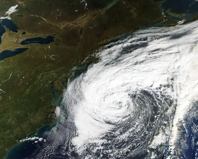
NASA’s 22 October image feature shows Subtropical Storm Josephine off the eastern United States. The Terra satellite captured the view a day earlier, revealing an uneven cloud pattern with heavier storm bands west of the centre.
NASA identifies Josephine as the Atlantic season’s tenth named storm. Its account explains that subtropical systems draw energy both from warm ocean water and from contrasts between warmer and colder air masses.
The image records conditions on 21 October. It is not a live forecast; current warnings and forecast updates are available from the US National Hurricane Center.
Sources
- NASA MODIS: Subtropical Cyclone Josephine: image and account, 22 October 2026
- National Hurricane Center: Current Atlantic advisories and forecasts
Compiled by The Meridian News Desk from the sources listed above. Eyewitness accounts are attributed and their verification status is stated. Where sources give different figures, both are shown.